

Rain and cooler temperatures are forecast but experts warn some areas may ‘miss out’
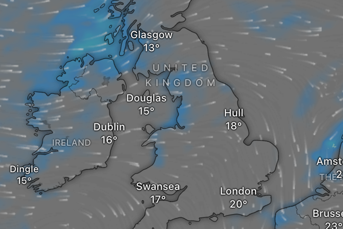
The UK may see some relief from the back-to-back heatwaves over the weekend as forecasters say temperatures are set to be cooler with a chance of light rain.
Many experienced the country’s fourth heatwave of the year in July, with temperatures reaching 35.2C on Wednesday – the seventh day in 2026 when temperatures have hit 35C or higher.
Paired with severely low rainfall, the hot weather has led to official drought conditions being declared for regions home to around half of England’s population, and the entirety of Wales.
Several other areas remain in high-risk prolonged dry weather status, with only north-east England and Scotland retaining normal status.
Parts of the North will be “chilly” on Friday, with light showers, the Met Office has said. It added: “Temperatures are expected to be much closer to average across most of the UK, and even slightly below average for northern Scotland.”
But southern regions are not set to see much rainfall, with weather forecast to remain largely dry.
Mark Sidaway, a Met Office deputy chief forecaster, said: “The forecast is showing potential for more rain than much of the UK has experienced over the last few weeks.
“However, it looks as though amounts of rain for many will be fairly modest, and won’t balance out the shortfall that we have recorded this summer. It’s still possible that some areas of the South will miss out and see little or no rainfall.”
The continued dry weather has prompted a string of wildfires across the UK, with fire chiefs warning that they are becoming a “recurring and growing feature of the risks facing our communities”.
July has seen firefighters tackle a record number of wildfires, at 393 in England and Wales. The number of wildfires in 2026 is now higher than the combined total of 2021, 2023, and 2024, but remains below the same point in 2025 when drought conditions were also experienced.
The UK Health Security Agency (UKHSA) has also warned that “is likely that 2026 could see the highest number of heat-associated deaths on record”, with 2,877 heat-associated deaths recorded during the heatwaves in May and June this year.
Patchy cloud in south-east England clearing. Sunny spells for many, but showers continuing across northern areas, becoming more widespread later and locally heavy. Risk of isolated thunderstorms in Scotland and Northern Ireland. Cool in the North West, with fresher conditions elsewhere.
Showers in the North easing and becoming confined to western areas. Mostly dry with clear spells elsewhere, with some showers in East Anglia. Cooler overnight in the South East.
Mostly dry with sunny spells. Showers affecting the far north, locally heavy, with a slight chance of thunderstorms. Rather cool in the North, locally warm in the South.
Mostly dry and bright, with showers mainly in the far north on Sunday. Rain may affect northern areas Monday and Tuesday, while southern areas stay warmer with sunny spells.
Join thought-provoking conversations, follow other Independent readers and see their replies